Marine and maritime industry requires high-quality long-term reference data and background information on the environment where commercial activities are being deployed. Regular LifeWatch sampling campaigns in the Belgian Part of the North Sea measure an array of environmental parameters that characterize the water column: nutrients, pigments, secchi depth, suspended matter, etc. The generated long-term data series allow us to produce interpolated maps for these parameters. A number of these data products are available below.
These interpolated maps below can be made for a range of parameters offered by LifeWatch. The different station data can be downloaded from the LifeWactch data explorer and an R tutorial lets you create standard interpolated maps for the desired parameters.
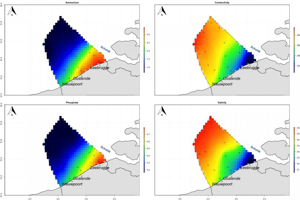
Example of interpolated maps created of the Belgian part of the North Sea for four parameters: Ammonium, Conductivity, Phosphate & Salinity