Alien species, which are organisms that are introduced in new ecosystems outside of their naturally occurring range, may have negative impacts on local ecosystems, industrial development, fisheries or aquaculture. Knowing the harm these can cause, it's useful to know what the invasion risk might be in the area of interest.
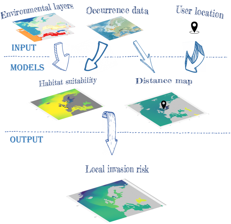
Local invasion maps are a useful tool to visualize probabilities of occurrence of invasive species in certain locations. The data inputs needed to create such maps are: Environmental layers, such as temperature or salinity raster layers (here retrieved from the BIO-ORACLE website), occurrence data of the species in question (from the WRiMS data portal) and the user location. The user location is defined by a manual input of coordinates. This renders a habitat suitability map and a distance map which are needed for the final product, a local invasion risk map.
A list of alien species in the BPNS can be found on the VLIZ wiki
(Last updated in 2012, Vandepitte et al., 2012)
The findingdemo package is an R package that lets the user create maps on local invasion risks for their species of interest. The maps are created by combining occurrence layers with temperature and salinity layers. The occurrence data can be accessed through the WRiMS data portal while the temperature and salinity layers are retrieved from BIO-ORACLE.
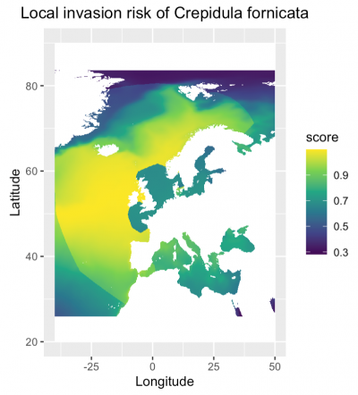
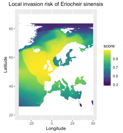
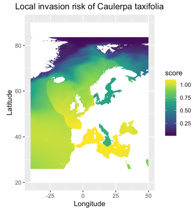
Examples for four different invasive species of the Belgian part of the North Sea are presented below